Virginia
Miles 470.6 – 1025.5, May 31 – July 12
The state of Virginia comprises approximately 544 miles, or over 25%, of the total length of the Appalachian Trail. As I sit here on the north side of the state I reflect on all of the experiences I’ve had over the last month or so it took me to hike it. There are a few defining moments that really stick out in my mind.
The 500 mile mark shortly after Damascus seemed to be stake in the ground for a lot of people. It’s a significant mile mark. We graduated from “maybe this is something I’ll do” to “wow we just hiked a shit ton of miles”. We could finally start doing the math. For me it was easy. I hit my 2 month trailversary (1/3 of the 6 months I expected it to take) at the 500 mile mark (1/4 of the trail). Clearly it didn’t add up. Numbers started being the discussion around the camp fire: if we hike 13 miles per day with no breaks we can still make it; only 16.5 miles per day average if you want to take a zero a week. These were frustrating to me because I still hadn’t shifted my mindset from a 12 mile a day hiker to a 17 mile a day hiker. And then the discussion started shifting to the weather.
8 days of solid rain forecast for the area. 1 to 2 inches per day. 100 percent chance of precipitation. As I’ve written about before, weather had a huge impact on everyone’s morale. The first couple of days weren’t terrible. Steady rain throughout the day, some breaks in the morning and evening allowed for time to setup camp and tear down. And then it got wet. Really wet. As I was hiking in the all-day torrential downpour I started thinking heavily about why I was doing this, and more specifically what else could I be doing right now that would be way more fun than sloshing through mud and water. I really wanted off trail badly, but really didn’t have anywhere to go. I also knew if I left the chances of coming back or being able to finish on time were low. I felt trapped in an uncomfortable situation that every part of me wanted out of.
But I kept walking. I tried to remind myself that I’m just uncomfortable. I’m not dying. I’m not starving. I’m not drinking contaminated water. Someone pointed out to me the other day that even the worst conditions we endure in the trail are far superior to what many people in this world live in on a daily basis. We have high tech shelters (tents), water purification systems, bags full of calorie-dense and protein-rich foods in our packs, shoes and socks to protect our feet, and warm clothing for the cold. There’s a lot to be grateful for.
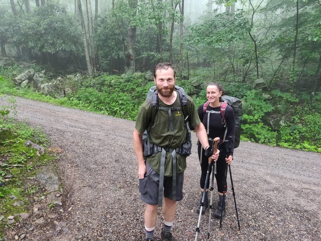
Still, hiking in the rain sucks. There seems to be an innate reaction to drops of water falling on us that causes us to seek shelter; echoes of mom’s voices yelling at us as kids to get out of the rain or we’ll catch cold. After two days and nights of hiking wet, setting up wet, eating dinner wet, and packing up wet the next day with a few more days of rain in the forecast and a few more days until the next town, I decided I needed to change my plan. I cut my hike short and called a hostel called Lick Skillet that was a few miles up the trail. I got their last bed and they’d pick me up at the trailhead.
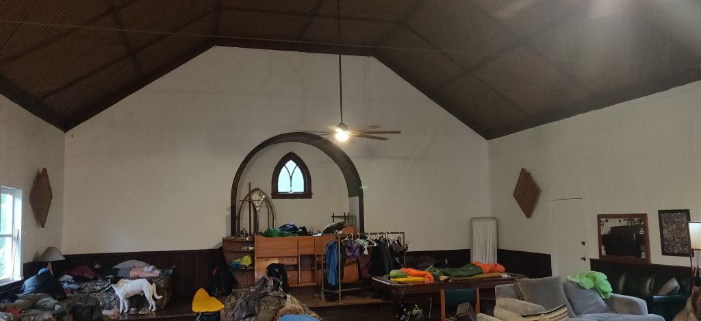
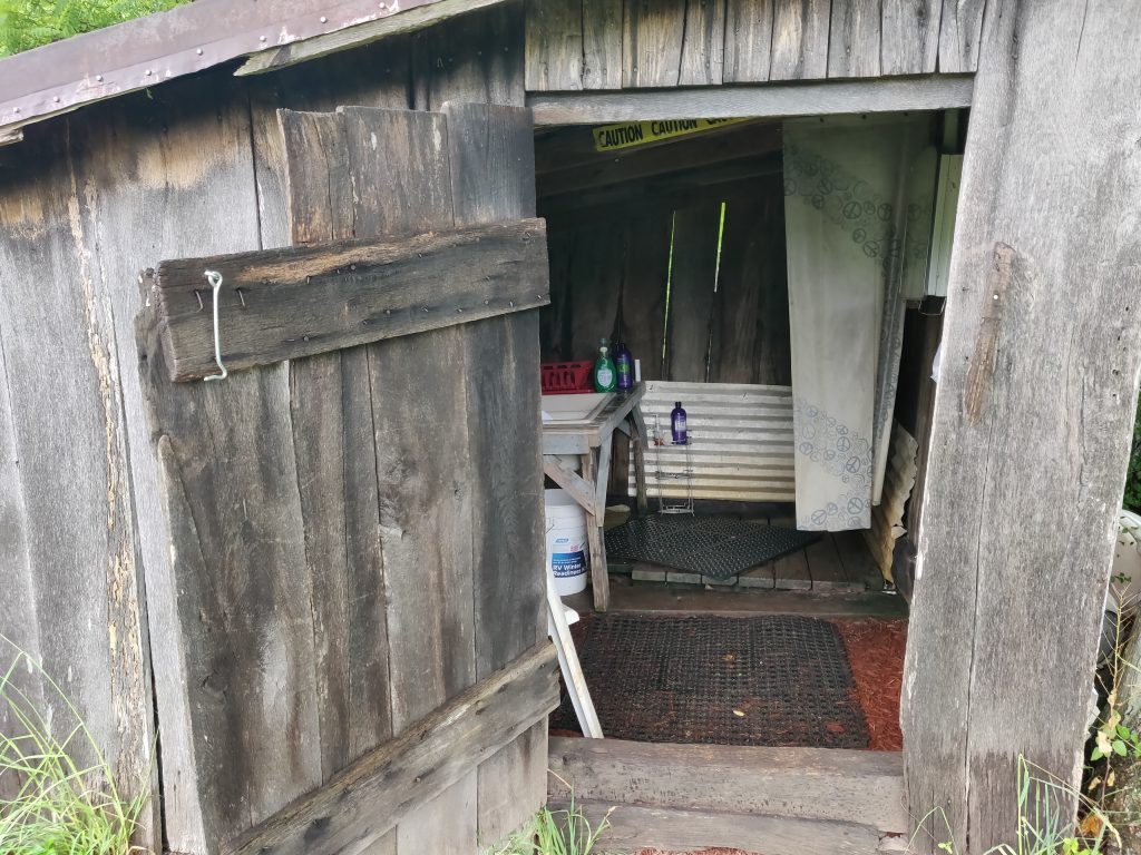
The hostel is a dozen or so beds in an old church building. It’s purely donation based. I showed up to some familiar faces on the trail, had a shower in the old shed out back, did some laundry and dried out my stuff. I was starting to feel normal again. A local church group brought in some Trail Magic for dinner — meatloaf, sweet potatoes, mixed veggies, biscuits, lemonade, ice cream and pie. Life was good again. I called ahead to another hostel 20 miles down the trail (Woods Hole) and asked if they could slack-pack me. They said no problem they’d pick up my bag and it would be waiting for me when I got there. The next morning I packed some water, my filter, lunch and snacks, and my rain jacket and set out to hike the miles. After training with a heavy (and wet) pack, hiking with just a day pack is a breeze. I was able to charge up the hills and practically run on the easy parts. The rain let up a little and the gentle sprinkle was pleasant compared to the previous few days of heavy rain. I met up with Jon and Heather, some friends I’ve been hiking with on and off. They were also headed to Woods Hole, and without my pack I was actually able to keep up with them for a change.
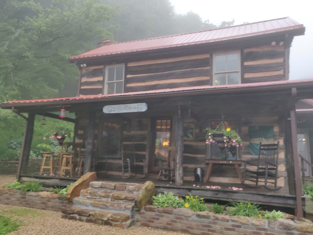
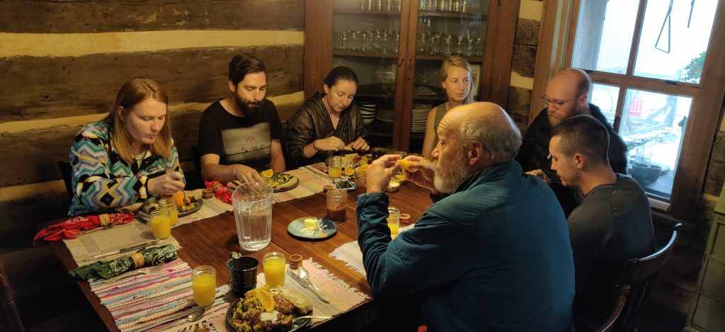
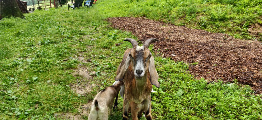
Hiking 20 miles was still no easy feat for me, but the hope was to arrive by 7pm. Woods Hole is known as one of the must-see hostels on the trail. It’s an old cabin, handed down from grandparents to granddaughter who runs it now. I had a private room reserved in the main cabin, but a separate bunk room also exists. The clouds nestled into the hillside and goats and pigs wandering the property created an idyllic scene as we arrived just in time for dinner after a long day of hiking. The organic gardens out front were used to prepare the fantastic (and affordable) meals they served. As I walked in, more friendly faces of my trail family greeted me. I really love the feeling I get when I wander into a shelter, or campsite, or restaurant, or hostel and hear “Storm Chaser!” called out as someone I just met in the last month or two is truly happy to see me there. And I was happy to see all of them too. As everyone scooted around the dinner table to make room for me to sit down, I loaded up with a generous plate full of salad from the garden outside, homemade dressings and freshly baked bread, and a warm hearty meal with friends and laughter. The day before I was miserable and ready to quit hiking altogether, and today was one of the best and most memorable days on the trail. Thanks to my friend Mike (Scooby) who reminded me when I was in the deepest part of the rut, “Just wait, it gets better.”
With the weather improving and my spirits high, I entered a region of Virginia known as the “Virginia triple crown” – three brutal climbs and descents in some of the most iconic scenery on the trail. Dragon’s Tooth was first, with a long climb culminating in huge rock formations at the top (which resemble dragons teeth) and some fantastic views. A popular spot for day hikers, I recall overhearing one woman say as I munched on my almost-moldy-tortilla, peanut butter, and beef jerky roll-up, “After this let’s go home and take a shower and then go out for pizza!” Ahhh day hikers, bless their hearts. A hairy descent involving some steep climbs down rocks was said to be practice for what is in store in Pennsylvania. One slip could result in serious injury, and it didn’t help I was doing it with a pack on.
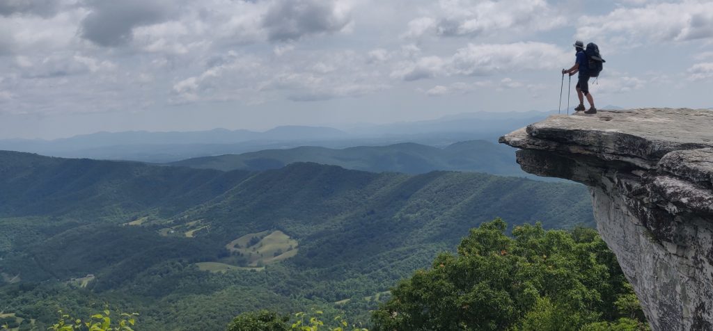
After the descent from Dragon’s Tooth I climbed up McAfee Knob. While the name might not be familiar, the photo most likely is. It has to be one of the most iconic images from the Appalachian Trail. Taken from the right angle it appears as if the person standing on the rock is suspended above an expansive vista. While it is a pretty shaky experience being out there, rocks on the other side make it not quite as dramatic as it looks. However it’s a spectacular view no matter where you’re standing, and it’s always really interesting to be standing in a spot that you’ve seen so many times in photographs.
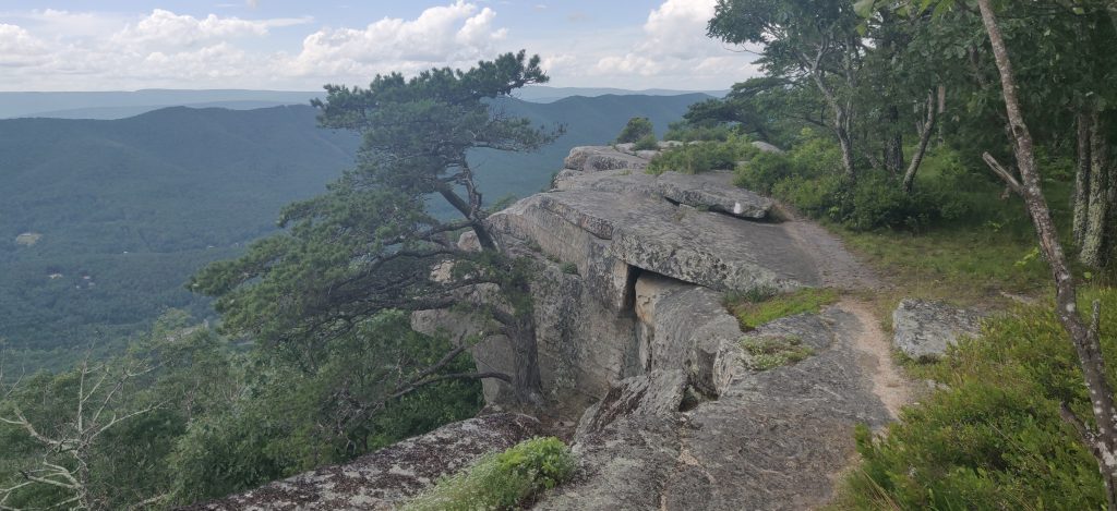
Finally, Tinker Cliffs rounded out the Triple Crown. The view is actually almost better than McAfee, and the trail follows the cliffs for quite a while. There are literally white blazes along the rocks with a sheer drop off and even placed where I had to jump over gaps that dropped dozens of feet. It was late in the afternoon and I approached the shelter. In this area you’re not allowed to “stealth camp” because of the amount of traffic and day hikers. I normally wouldn’t stop this early, but I was 8 miles from town and somewhat tired from hiking the 3 peaks that day. But something urged me to press on so I kept hiking. The a thunderstorm rolled in and soaked me. After my previous experience with rain this didn’t really bother me. I’m fine with a storm blowing through and getting me wet if it’s going to dry out afterward. But the trail was very rocky and became slick when wet. This slowed me down a lot, and it soon started to get dark. I was still 4 miles from Daleville when I had to pull out my headlamp. Fortunately the rocks diminished as I descended, and I finally hit town around 10:30pm. Knowing I’d be warm and dry provided some incentive. I ordered a pizza and salad to my hotel room and proceeded to eat the whole thing myself. This was my first 20+ mile day with my pack on, and one of the most challenging hikes yet, so I definitely earned the big meal.
The last notable part of Virginia was the Shenandoah National Park up north. Most of my trail family had decided to “aqua blaze” this section of the trail by renting canoes and paddling down the Shenandoah River instead of hiking the park. I seriously considered it for the social aspect and possibly as a way to catch up a couple of days since I’m feeling behind. The hike through the Shenandoahs is considered to be relatively easy; the terrain is not challenging, the trail is groomed for tourists, and there’s literally a snack bar every 10 miles. But the planning required for aqua blazing seemed to be too stressful, and by hiking I could hike my own hike. In the end I’m glad I decided to hike. Lots of people capsized and lost their phones and gear. The river is low in spots requiring portaging the boat. It didn’t sound very fun. On the other hand, the Shenandoahs were not as great as I would have hoped for a national park. The hike was not that interesting, there were tons of tourists, and really I was just looking to get through it.
The first day I was able to hike my first marathon. It was forecast to be cooler and dryer, the terrain was relatively easy, and I set my alarm for 6am. I was on the trail by 8am (still good for me) with the goal to hit the second shelter. The first one was 13 miles up. I stopped there for lunch. Having enough food handy was important to keep me going. Another 13 miles (plus a little for blue blazes and a detour) and I finished at 26.8 miles for the day. The goal was mostly to check it off the list of challenges so I didn’t have to do it again, but it was a confidence booster to know that I could for sure.
Leaving the Shenandoah National Park put me on the path to the 1000 mile marker, and shortly thereafter crossing into West Virginia. After spending nearly a month crossing Virginia on foot, the new state (number 5 of 14) was a welcome sight. Harpers Ferry, WV is the “psychological halfway point” and Appalachian Trail Conservancy headquarters. I got my picture taken and weighed in at 191 lbs, down 37 lbs from when I started. The next section takes me through Maryland and Pennsylvania. The states here are do small that some more dedicated hikers will attempt the Four State Challenge: Virginia, West Virginia, Maryland, and Pennsylvania can be hit in 44 miles in 24 hours. While I’m going to skip that one, I’m looking forward to my next challenge: eating a full half gallon of ice cream at the halfway point, just because I can.
4 thoughts on “Virginia”
Your blogs make me smile. Love reading your adventures. So proud of you! Congrats on the half way point.
Great reading about your adventures, I hope you gather enough mustard to go all the way, you go boy
I know you got to eat that half gallon sugar abundant ice cream…your writing is amazing…it puts one hiking next to you experiencing your experience only dry…keep on trucking….
I’m going to walk 26.8 feet around my house and then eat a whole pizza.